Covid 19 Hotspots

Discover Kgothatso Innovations

What We Do Location Intelligence
- consulting service
- Geographic Information System
- Remote sensing
Services Consulting Services
- Engineering: Infrastructure development, and asset management.
- Environmental Management: EIAs, agriculture, land management, field data collection
- Mining: Prospecting, exploration and resource mapping.
GIS (Geographic Information Systems)
- Spatial data analysis
- Mapping
- Geodatabases
- Data conversions (CAD to GIS)
- Mobile field data collection
- Digital twins
- Land information systems
- Geospatial reports
- Spatial development frameworks
- Data portal (cloud)
- Infrastructure monitoring
- Property valuations
Remote Sensing
- Natural resources studies
- Imagery analysis
- Mineral exploration
- Ground subsidence analysis
- Aerial surveys
- Tailings dam monitoring
- Earth observations
- Change detection
- Temperature monitoring
- Crop analysis & monitoring
- Climate change studies
- Capacity building / Training
Industries We Serve
- Agriculture
- Engineering
- Environmental
- Legal
- Mining
- Urban/Town Planning
Complementary Channel Partners

Projects


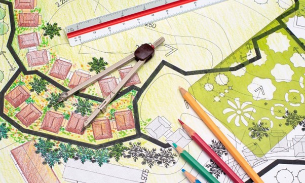
Geospatial Planning: The Importance of Location-Based Decisions

By taking into account things like climate change, traffic patterns, and crime rates, geospatial planners are able to make more informed decisions about where to locate new development. While traditional planning methods are still used in many places, the advantages of geospatial planning are becoming more and more apparent. Geospatial planning can help us to use our resources more efficiently, make our communities more livable, and reduce our environmental impact.
What is Geospatial Planning?
Geospatial planning is the process of incorporating geographic information into the planning and decision-making process. This can be done using a variety of methods, including mapping, GIS (geographic information systems), and GPS (global positioning systems).
How Does Geospatial Planning Work?
Geospatial planning takes into account the physical location of features when making decisions
about where to locate new development. For example, a geospatial planner might consider the
proximity of a proposed new school to existing homes and businesses when deciding whether or not
to approve the project. Geospatial planning can also help us to understand how our communities are changing over time. By tracking the location of new development and changes in land use, geospatial planners can identify trends and patterns that would be difficult to see using traditional methods. This information can be used to make decisions about where to locate new businesses or how to best allocate resources.
What Are the Benefits of Geospatial Planning?
There are many benefits to using geospatial planning when making decisions about the development
of our communities. Geospatial planning can:
• Help us to use our resources more efficiently: Geospatial planning can help us to make better use of our land, water, and other resources. By taking into account the location of existing development, geospatial planners can identify areas that are underutilized or where new development would have a greater impact.
• Make our communities more livable: From street design to the location of parks and other public spaces, geospatial planning can help us to create more livable communities.
• Reduce our environmental impact: As our population grows, it is important to make sure that new development does not have a negative impact on our environment. Geospatial planning can help us to identify areas that are environmentally sensitive or where development might have a negative impact on wildlife.
• Improve our economy: By making informed decisions about where to locate new businesses and development, geospatial planners can help to improve our economy.
The Bottom Line
Geospatial planning can help us to use our resources more efficiently by taking into account the
location of buildings, streets, and other features when making decisions about where to locate new
development.
By understanding how our communities are changing over time, we can make better decisions about
where to allocate resources. Geospatial planning can also help us to reduce our environmental impact by making informed decisions about where to locate new development. Need Help with Geospatial Planning? If you need help with geospatial planning, the experts at Kgothatso Innovations can assist you. We have a team of experienced planners who can help you to make the best use of your land and resources. Contact us today to learn more about our GIS and mapping services.
Location of vaccination sites
Locate, analyse, manage – GIS allows you to do just that. Here is a map to help you locate vaccination sites in South Africa, starting with the Gauteng province.
Using ArcGIS online, a cloud-based mapping and analysis solution, the map allows you to zoom in, for example, to your residential area, click on a site and a pop up with information on the site appears.
Credits: Municipal Demarcation Board, Department of Health Official COVID-19 Website, Esri South Africa, Khanyisa Mpisane, Given Mabaso
Disclaimer:
The sites provided do not represent an exhaustive list of all the vaccination sites.
We therefore welcome additional sites to add on to the list. However due to business responsibilities during the day, we can only make updates on a regular basis. We kindly request your patience should you contribute in this regard.
Surviving Covid19: The role of Location Intelligence in Business Continuity
Ndilisa Didiza, CEO, Kgothatso Innovations
The Covid-19 Pandemic, that caused the world to stop, has not been dissimilar to when a vehicle, with occupants in, is suddenly forced to stop. In worst cases life threatening injuries occur and at best we are left disoriented with our hearts in our proverbial mouth. This has been the case for the majority of businesses in South Africa both large and small. The sudden suspension of economic and business activity has left most having to bear ongoing operational costs without corresponding income. Even though government has put together measures to cushion the blow, some businesses will be knocked out and yet for those that survive, great opportunities await.
Which are the businesses that survive?
In Disaster situations the likes of which we are now faced, it is those businesses that prove to be adaptable, flexible, and intuitive in responding that will have the best chance of surviving. This implies having insight into the nature of the disaster and utilising technology as a key instrument in how business is conducted, and decisions are made. How the technology is to be utilised and in what ways to allocate resources are questions best answered by Enterprise GIS.
What is Enterprise GIS?
Enterprise GIS allows use of mapping software throughout the business; maps give context and add richness and depth to business decisions. Now more than ever, when business is confronted with disaster, it needs to know that all the plans are in place and the business has contingencies to mitigate unexpected events. Most businesses have been left exposed because they have always been conducting business as usual and ignored, or worse, forgot about the importance of having a Business Continuity Plan, and not just any plan, but a Geo-centric Business Continuity Plan.
Executive dashboards can be built using real-time news feeds and notification systems. An example being the Covid-19 Dashboard on your right, built on an Esri Platform.
Real-time data feeds can be combined with mapping and GIS analysis.
Tracking applications can be installed on the Web-Viewer that can trigger notices and map views for the business continuity manager
A Business Continuity Plan?
A Business Continuity Plan gives you the how to, in the event of a disaster or unexpected business disruption. It enables an organisation to mitigate risks that may cause disruptions in areas such as health and safety, loss of productivity from downtime, loss of work to competitors, failures within the supply-chain, penalties from regulators, and higher resultant insurance premiums. Regardless of industry or size, all companies have responsibilities from a compliance standpoint. A Business Continuity Plan assists in monitoring and tracking compliance from these perspectives.
What If I have Multiple Sites?
Each site has unique characteristics that are influenced by its location. Businesses that have operations in multiple sites across a city or country, require a geocentric Business Continuity Plan. It helps to strengthen and formalise organisational preparedness and response to disaster, enabling timely and cost-efficient response while reducing the cost of business disruptions on human lives, operations, assets, and financial resources.
Source: Kgothatso Innovations Mapping Division
Joburg Metro Covid19 Cases Map View
A Geocentric Business Continuity Plan utilises the Map for:
- Understanding locations of highest risks
- Identifying employee households at risk
- Understanding centres of social unrest and increased risk
- Locating the closest health centres such as clinics or hospitals for employees
- Identify safe areas where business can continue to operate
Kgothatso Innovations and ABMI have developed a geo-centric business continuity management solution that not only integrates the attribute-based maturity index (ABMI) practice guideline D3 with BCP best practice but does it on a GIS platform. Kgothatso’s ABMI inspired GIS, can develop event scenarios and map outcomes efficiently, allowing seamless responsiveness.
Geocentric – BCP Flow chart
Our Solutions cater not just for big enterprise clients but also for small to medium scale operations that need Business Continuity Solutions that fit within their budgets. To this end we have an Outsourced GIS office that would provide the skills and manpower required to support geocentric decision making without the prohibitive labour overheads that can strangle the business’ capacity and responsiveness.
https://kgothatsoinnovations.co.za/outsourced-office/
Kgothatso Innovations understands how geographical information systems can add value to your business.